Found total of 13 items and showing 12 items on page 1 of 2
GeoBytes for Spatial Insights #2 – GIS in Flood Hazard Mapping
22 Oct 2025 13:00 — 13:45
Online via Teams
Registration is NOW CLOSED
Join the GISMEO community for a quick-fire webinar on how GIS supports global flood hazard mapping — from hydrological modelling and spatial data integration to quality assurance and real-world application.
Highlights from GISMEO's Humanitarian Mapathon Event
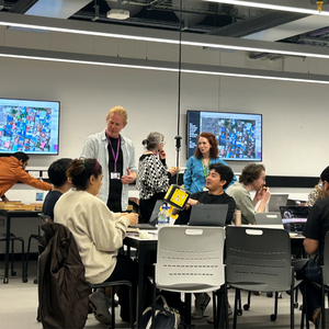
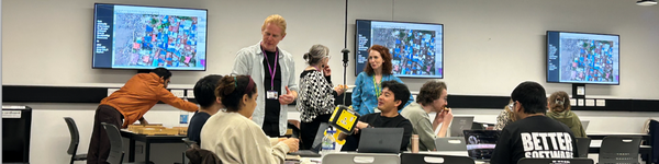
We recap on the GISMEO Community’s second in-person event, the Humanitarian Mapathon, held on 7th May. The event brought together 20 participants from diverse disciplines to explore the power of geospatial tools in humanitarian contexts. It contained practical sessions on humanitarian mapping and served as a valuable networking opportunity, fostering meaningful connections among attendees.
Kick start your GISMEO career
21 May 2025 11:00 — 13:30
Online via Zoom
Registration is NOW CLOSED
Join the GISMEO community for an inspiring event dedicated to careers in Geographical Information Systems, Mapping, and Earth Observation. Gain valuable insights from professionals who have successfully navigated these industries, expand your network, and discover the support available through the careers service to help you take the next step in your journey.
GISMEO: Invites you to a Humanitarian Mapathon
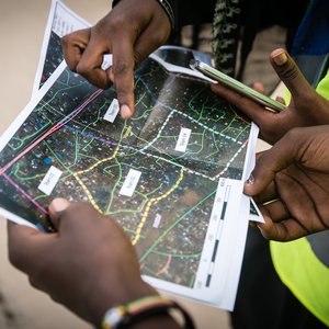
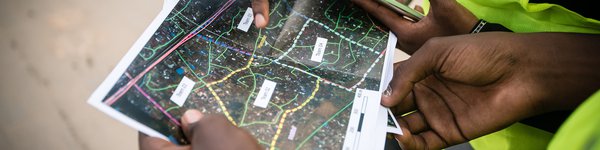
The GISMEO community invites you to get hands-on at their next Humanitarian Mapathon event with pizza 🍕🍕🍕!
Join experts in the field, our special guests Pete Masters, Special Project Advisor at Humanitarian OpenStreetMap Team (HOT), Dr Kirsty Watkinson, Research Associate at SEED, and Dr Martin Parham from the Humanitarian Conflict Response Institute.
GISMEO: Humanitarian Mapathon with Pizza
7 May 2025 13:00 — 15:30
In person at the Engineering Building Room B_2B.025 (M&T)
Registration is NOW CLOSED
Join our Humanitarian Mapathon! This coordinated mapping event offers participants the chance to learn about humanitarian mapping from experts and gain hands-on experience. Bring your laptop and enjoy some pizza 🍕!
Championing GISMEO


As co-leader of the Geographical Information Systems, Mapping, and Earth Observation Community (GISMEO), Gail Millin-Chalabi stands out as a champion for innovation and knowledge sharing. This article explores Gail's background and her interests in GIS, the environment, maps, art, and the world of Beatrix Potter!
Maps and Mince Pies


The GISMEO community hosted a festive event, showcasing the University's map collection and captivating attendees with fascinating stories behind the maps.
Geographical Information Systems in Action


On World GIS Day, the Geographical Information Systems, Mapping and Earth Observation (GISMEO) community met to focus on GIS and showcase some applications at the University.
GISMEO Maps and Mince Pies
5 Dec 2024 13:00 — 15:00
The Map Room - University Library
Registration is NOW CLOSED
The GISMEO community are excited to celebrate the University’s map collection at this special event.
GIS in action a GISMEO community event
20 Nov 2024 12:30 — 14:00
Online via Zoom
Registration is NOW CLOSED
Discover how GIS is shaping research, teaching, and well-being initiatives across the university. Hear from guest speakers, explore real-world applications, and share your feedback to help guide the future of GIS. The event will conclude with an interactive Q&A.
Connecting the GIS, Mapping & Earth Observation Community


We are happy to report that during its first community event, the GISMEO community has already produced new connections and opportunities for its members.
Launch of GIS, Mapping and Earth Observation Community
24 Jul 2024 13:00 — 14:00
Online
Registration is NOW CLOSED
Join researchers from across the University for the launch of the new Geographical Information Systems, Mapping and Earth Observation community.