Found total of 57 items and showing 12 items on page 1 of 5
First In-Person Event of the CaDiR C++ User Group
27 Apr 2026 10:00 — 14:00
Various
Registration is closing soon
The first in-person event for the University C++ user group has been announced. They are looking for flash talk presenters as well as attendees!
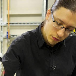
Promoting C++ at the University
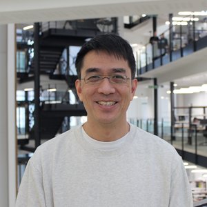

Meet Dr Raymond Wan, Research Associate in the Department of Chemistry and one of the leads of the University C++ User group. Discover how they are reaching out to C++ users across the University and how you can get involved.
Supporting the University UK Biobank User Group

The University special interest and user groups could not happen without the input of the group leads. Meet Dr Robert Maidstone from the School of Biological Sciences who is one of the leads for the UoM UK Biobank Users group.
Green Compute for Research @UoM


A new special interest group has been launched for anyone interested in the environmental impact of research computing at the University. Find out more about the aims of the group and how to get involved.
Promoting R at the University

The R user community (R.U.M) is one of the most established user groups in CaDiR having previously existed for several years before this as a mailing list group. The group is led by a combination of Research IT members and researchers including Sian Bladon from the School of Health Sciences.
Building the Python User Community at Manchester

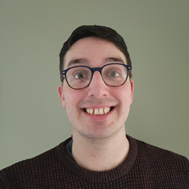
It's been almost a year since the Python User Group launched in the CaDiR Teams space. We caught up with Andrew Gait, one of the group leads, to find out more his role in the group and how the last year has gone.
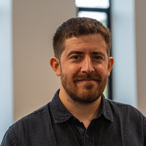
Driving the C++ User Group
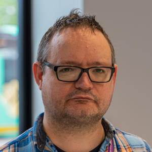
Meet Russell Garwood, Senior Lecturer in the Dept. of Earth and Environmental Sciences and one of the academic leads of the University C++ User Group. Discover how he got involved with the group and what it offers the C++ user community at the University.
Manchester Research Software Community Oct 25
29 Oct 2025 10:30 — 12:00
Hybrid
Registration is NOW CLOSED
Manchester Research Software Community (MRSC) are excited to announce their next meeting on Wednesday, 29th October 2025. We will be continuing with the collaborative format of the meeting and are excited to invite lightning talks from the community!
Advancing R at the University

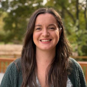
Meet Martin Herrerias Azcue, Research Software Engineer in Research IT and one of the leads of the R User Group at The University of Manchester (R.U.M.). The group serves as a hub for R users, providing a lively, engaged community where everyone is welcome to ask questions and to share their R knowledge.
Launch of the C++ User Group

The Computation and Data In Research (CaDiR) community continues to grow! This is a new space for University staff and researchers who work with C++, whether they are experienced systems programmers or beginners. The group aims to create an inclusive community of practice for those involved in simulation codes, high-performance libraries, or object-oriented design.
Highlights from GISMEO's Humanitarian Mapathon Event
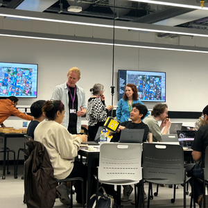
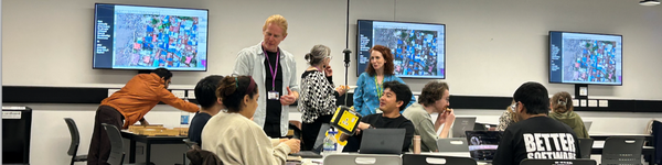
We recap on the GISMEO Community’s second in-person event, the Humanitarian Mapathon, held on 7th May. The event brought together 20 participants from diverse disciplines to explore the power of geospatial tools in humanitarian contexts. It contained practical sessions on humanitarian mapping and served as a valuable networking opportunity, fostering meaningful connections among attendees.
Driving change: Dr. James Bird and ERNs

Meet Dr. James Bird, a driving force behind the University's Electronic Research Notebook (ERN) initiative and ERN community leader. As a researcher turned technical specialist, James shares his journey, his commitment to research data management, and his vision for building a vibrant ERN community.